–
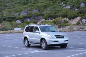
When we set out to full time, one of the things I wanted to do but wasn’t sure I’d be able to do was to go off roading in our toad. It was an important part of my decision to select the Lexus GX470. The car we bought had aged out tires so we replaced them with Goodyear Wrangler mud/snow tires as well so we were really ready.
But finding out how to do this is easier said than done. There are trail sites that charge you money to find the trail head. There are iPhone apps as well that are paid. We generally have a policy to avoid purchasing applications or website subscriptions that don’t help us more than a few times per year so we really needed to find a free solution to make this happen and this is it.
Imagine you have a pretty good idea where a trail is that you can go on. You drive down the road and you find a trailhead. It’s completely unmarked. Maybe there is a number there. There are no no tresspassing signs but do you really feel comfortable going down the road? I really didn’t until I figured out our current solution. There is an iPhone app called PDF Maps. The app is free and can be readily downloaded. They make money by charging for some maps but as it so happens some federal maps are free on the app.
The unique thing is that the app will overlay your GPS position on the map thereby showing you when a trail is approaching or whether or not you are on the right trail or the immediately adjacent “you will be shot on premises” private property. There are maps in this application called MVUM. Motor Vehicle Use Maps. They literally show you federally owned trails which you are allowed to take your off road vehicle romping on. Sweet! There are some restrictions which are outlined in the PDFs.
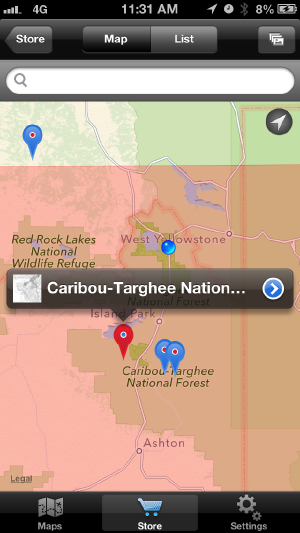
The first thing you would do is start the application and then click the search map button in order to browse the available maps for your area. There are various topographic and almanac maps but you want the MVUM.
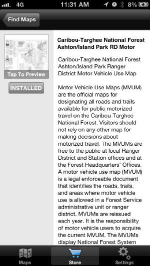
Once you go in further you can see more information about the map and any pricing. Again, MVUM’s are free.
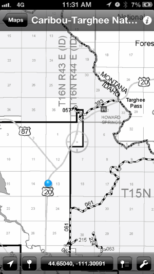
Once you’re happy with your selection you can download the map and then launch it, showing your GPS overlay.
Those black and white striped roads? Those are basically traversable dirt roads, someimtes with large rocks, climbs and center height clearance needs. Worked fine for our Lexus and should work fine for a Jeep. I enjoyed going down these roads to learn more about offroad driving while simultaneously showing the family a view from the mountaintops that others don’t always get to see. We saw remains of campsites, evidence of bears and more. When you have a toddler this is pretty much your only option to go about this versus an ATV, hiking, etc.
Have fun!
Last modified: 21 October, 2014
Created: 1 October, 2014


